
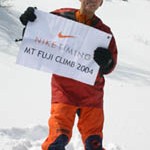
David Lim’s Winter Climb on Mount Fuji, March, 2004
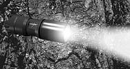
 Incorporating the latest LED technology, LongBow’s expandable range of LED flashlights is the choice of the Nike Timing Fuji Climb
Nike Timing’s Oregon Alti-Compass is David Lim’s idea of a rugged, multi-functional outdoor timepiece. Used for both his 2004 Kilimanjaro climb and the Mt Fuji Winter climb
The Climb Report!
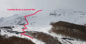
The team comprising David Lim, WongTing Sern and Masaharu Mutsuyoshi began their ascent from the Yoshida trailhead. The road to the usual Kawaguchiko route ( trailhead at 2350m ASL ) was closed so the ancient Yoshida route was chosen.
Ting Sern near the beginning of the Yoshida Trail
L to R: The Yoshida Trail and David up high on Fuji
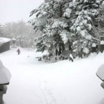
The trail began at about 1050m ASL and the team plodded up in shin-deep snow for 10 hours, covering 1100m of vertical ascent. This was quite hard work because of the 18 kgs+ packs the team were carrying. David and Masaharu set up camp at 2015 hours and Ting Sern turned up an hour + later, quite exhausted. He had never carried a load that heavy up such a significant elevation gain.
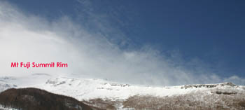
The following morning the team set off to check the route. As anticipated, the snow was even more sof and unconsolidated. WIth dark lenticular clouds and strong winds ripping the summit area, the climb was called off. The team had a spare day, but with more bad weather approaching , it seemed academic.
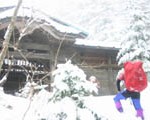 Masaharu by one of the Shinto shrines
Though somewhat disappointing, Masaharu later re-framed the experienced positively. The solemnity and silence of the snow clad forests; and the many ancient lodges and shrines we had passed lent an enriching element to our short time together, he said.
I agree. There are more important things than the summit.
Until next time, stay tuned.
L to R: Masaharu and Ting Sern, dining on Toyama cuisine in Tokyo!
Wet wet Shinjuku, March 25
PRACTICALITIES:
In th off-season, catch a train from Shinjuku station in Tokyo to Kawaguchiko or Yoshida. From here, hire a taxi ( expensive ) to go up either trailhead. The Kawagichiko trailhead starts at 2350m and the distance from the gate to where the trail starts is a metalled road ( about 20 kms ). The Yoshida Trail starts much lower, at 1100m. Other routes like the Gotemba on the south east side also start lower down ie 1400m ASL. Some buses may run from the small town to the KWG trail head in Springtime but worth a check before you go. No permits are needed for Fuji but it is worth ( in the offseason ) informing the local police station of your intentions. You can camp anywhere ( although officially forbiddemn ) in winter since you are unlikely to meet anyone. In the summer or late Spring – much easier transport facilities.
The Mountain:
Fuji-san, at 3776m is the highest mountain in Japan. It is an isolated volcano, located only 80km southwest from Tokyo, which contributes to its popularity. The mountain is now dormant, but it has erupted eighteen times in recorded history, and many more times according to geological evidence. The last eruption occurred in 1708.
Thousands of climbers, tourists, and religious pilgrims ascend to the summit each year. The mountain has traditionally been sacred to the Shinto religion, and has remained sacred to Buddhists as Buddhism has become Japan’s predominant religion. Three temples (plus a weather observatory) have been erected on the summit. However, out of the summer season, conditions on the mountain can be of Himalayan proportions in terms of hurricane-force winds, snow and sub-zero temperatures.In late 2003, four climbers were blown off the mountain with one fatality.



Leave a Reply